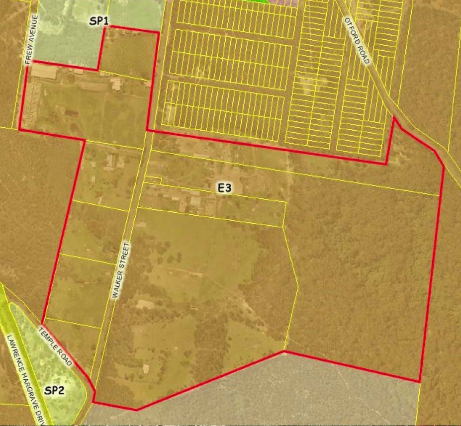
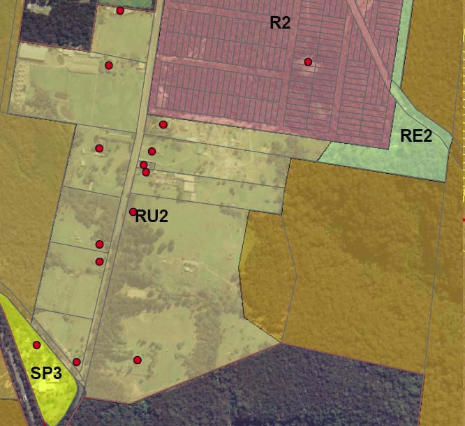
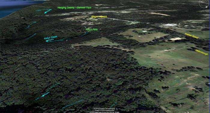
WALKER STREET PRECINCT
Click on photos  to see larger images below

Walker Street Precinct

Walker Street Precinct

Walker Street Precinct

WCC Recommendations
It is recommended that a planning proposal be prepared to amend the Wollongong Local Environmental Plan 2009 by:
• Rezoning the majority of the precinct to RU2 Rural Landscape, and the eastern part be zoned E2 Environmental Conservation.


Please e-sign the submission letter below to protest at the proposed development zonings for the Walker Street precinct

Kellys Falls Stanwell Tops from Walker Street
- A brief review on the different precincts proposed for 2508 -submission letter  
- general submission letter on retaining the E2 environmental protection across the majority of the 2508 area

The Administrators
Wollongong City Council
Locked Bag 8821
Wollongong 2500

Preliminary Review 7D Lands - Walker Street Precinct  - Helensburgh

To:
Any Additional
Comment
you'd like to include  
:
Lette:
  
The Walker Street precinct be zoned E2 Environmental Conservation. In summary, this whole area must be E2 Environmental Conservation because Kellys Falls is adjacent to this area which is a E1 National Parks and Nature Reserves of the National Heritage Listed Area Garrawarra State Conservation Area and in turn, a tributary of the
(Class P) Hacking River.  All stormwater and run off leads directly to the Hacking River.  The effect of any excavation and land clearing on this section of Helensburgh plateau  is evident at every rainfall, as downstream become extremely turbid with clay deposits and Helensburgh refuse.   Containment ponds in Helensburgh have failed , and more will not help.  The only method to retain the relative purity of the Hacking catchment and river, is to cease and prevent any new development, and restore degraded land to native bush.
The reason for not zoning as RU1 is the properties are cleared and rural nature. This will ensure a large wildlife corridor and as themost desired area for urban development, prevent future developer pressure.
      I do not support the zone downgrading of environmental protection of any '7D' land in the 2508 region.
Whilst the preliminary report on submissions of the 7D review, has wisely recommended some areas of the Otford Valley and Helensburgh to be zoned E2, it does not extend far enough to cover all the Hacking tributary creek areas. In particular lots between Lady Wakehurst and Otford Road, Otford. These forested lands are an essential thoroughfare between the National Heritage Listed "Royal National Park" and Stanwell Tops. Consequent development from an E4 zoning combined with the deer-proof fence along the railway line would completely block the movement of native wildlife to the river and escarpment - 100% fatal to the native wildlife of the National Heritage Listed "Royal National Park" during bushfires.

Generally, the E2 zone needs to cover as great an area as possible from Bald Hill and the Stanwell Tops Hanging Swamps to the SCA land on the F6 freeway, north to Garrawarra and East to Otford Lookout on the cliff of the Pacific Ocean, as per the Gateway submission by Otford Protection Society Incorporated.

The 2508 region has greatly increased in environmental significance since it was first founded and initially subdivided. Century old paper subdivisions that were created around a shanty town and bullock tracks, do not carry development rights. Particularly in a highly sensitive environment that is crucial to the survival of the heritage listed National Heritage Listed "Royal National Park" and temperate rainforest that is home to endangered wildlife.

For a over a hundred years the same thick forest has filtered the air between Wollongong and Sydney, and provided a strong buffer against coal dust and particles from the Helensburgh metropolitan mines. To reduce or thin the forest buffer will risk the respiratory health of thousands of residents.

3D photo/topographical map clearly show how vulnerable the rivers, valleys, bushland, wildlife and conservation parkland are to the activities and industries on the Helensburgh plateau. All emissions whether stormwater, chemical waste, eroded soil, weeds, litter or feral pets eventually move into the valleys. So the impact of even just one cleared lot for a single dwelling can have long term and far reaching consequences.

Land holders that have deliberately degraded their land to encourage rezoning should not be rewarded with new development rights. The lands still straddle tributary creek catchments and can still be regenerated. The building of a service station, McDonalds take-away or brothel will not benefit Helensburgh as a whole. But if E2 zone can be reinstated, the litterol forests and an attractive Princes highway gateway to the area can be restored. So we do not support the proposed B6 enterprise corridor nor further development around the Wilsons Creek tributary, Camp Creek, Herberts Creek or Gills Creek tributaries.

The surrounding Sydney Metro and Wollongong surburbs have consumed and fragmented so much natural bushland with development and the necessary freeway networks, that the only remaining wildlife corridor between the National Heritage Listed Royal National Park, Garawarra, State Conservations area and to the Illawarra is through Helensburgh, Otford and Stanwell Park.

To 
ensure the 2508 environment continues to be protected, any 7(d) zoned land should all be zoned E2, but allowing replacement of existing buildings, in the event of disaster.

Yours faithfully
Name:
Phone:
Email:
 Address:
Email me
updates:
Yes
No
              OnSubmit, form letter will automatically be forwarded to
              records@wollongong.nsw.gov.au.
              Or you mayprint it out to post a hard copy to them